Embark on a Journey of a Lifetime: Explore the Mystical Beauty of the ChandraTal Trek
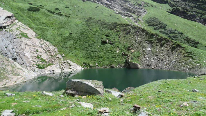
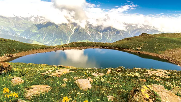
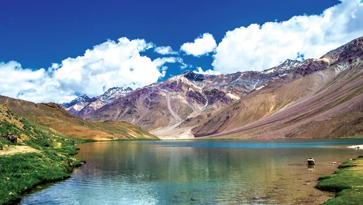
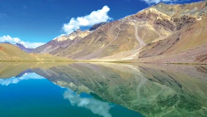
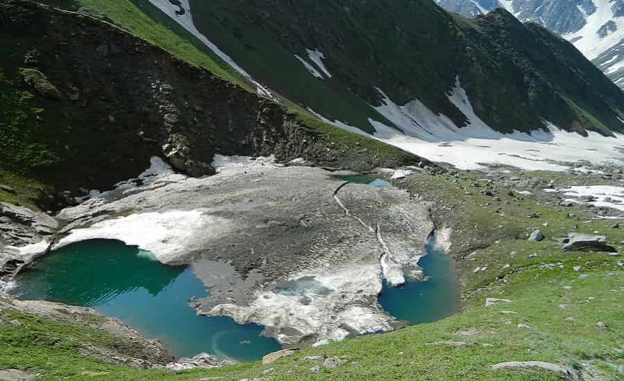
Chandra Taal, also known as Tso Chigma or Chandra Tal, is a crescent-shaped lake situated in the Spiti region of the Lahul and Spiti district in Himachal Pradesh, India. It is located near the source of the Chandra River, and despite its rugged and inhospitable surroundings, it is home to some exquisite flowers and wildlife during the summer. Chandra Taal is a popular tourist destination among high-altitude trekkers and visitors due to its serene natural beauty. Although it is typically associated with Spiti, it is geographically separated from the valley by Kunzum La.
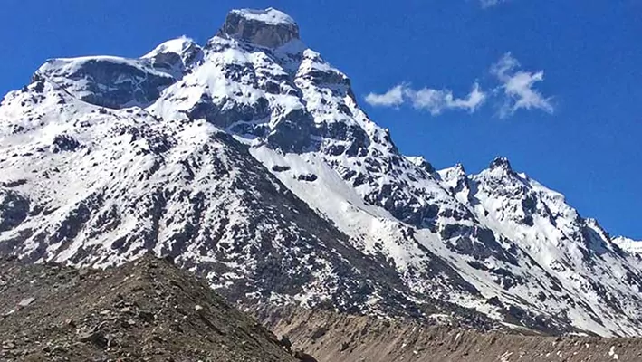
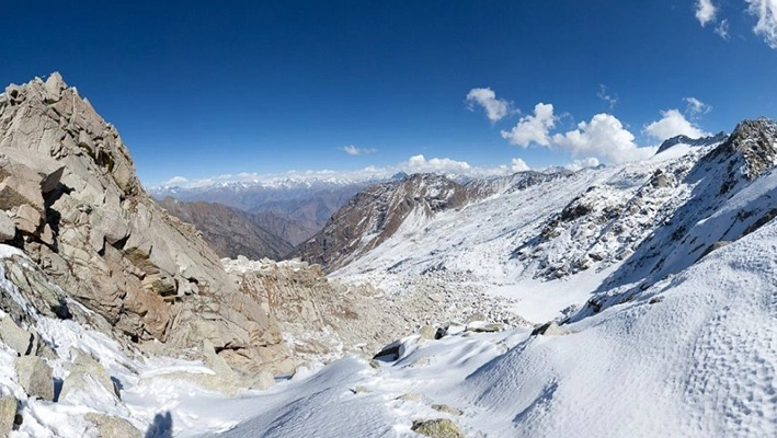
The lake is located on the Samudra Tapu plateau, offering breathtaking views of the Chandra River, a source river of the Chenab. It sits at an altitude of approximately 4,300 meters (14,100 ft) in the Himalayas, with mountains of scree on one side and a cirque on the other side enclosing it.
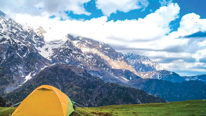
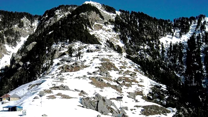
Chandra Taal is a popular destination for trekkers and campers, accessible by road from Batal and on foot from Kunzum Pass from late May to early October. From the NH-505, a road branches off about 2.9 kilometers (1.8 mi) from Batal and 8 km (5.0 mi) from Kunzum Pass, leading to a parking lot 1 kilometer (0.62 mi) away from the lake. The final 1 kilometre1 km (0.62 mi) to the lake needs to be traversed on foot, taking approximately two hours from Kunzum Pass. The lake can also be reached from Suraj Tal, which is 30 km (19 mi) away.
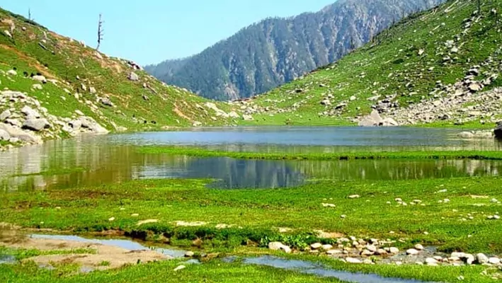
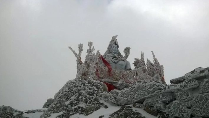
The lake’s banks are lined with vast meadows that are home to hundreds of varieties of wildflowers during springtime. However, due to overgrazing, the grasslands have degraded over time. Chandra Taal is home to several species of wildlife, including the Snow Leopard, Snow Cock, Chukor, Black Ring Stilt, Kestrel, Golden Eagle, Chough, Red Fox, Himalayan Ibex, and Blue Sheep. These species have adapted to the harsh climate and lack of oxygen by developing unique physiological features. In the summer, migratory species such as the Ruddy shelduck can be spotted.
Chandra Taal is one of the two high-altitude wetlands in India designated as Ramsar sites. Despite its pristine beauty, tourism has started affecting the lake’s ecosystem.
What To Watch Out For
If you’re planning to trek to Chandratal Lake in Himachal Pradesh, India, here are some things to watch out for
- Altitude sickness: The Chandratal trek takes you to a high altitude of 4,300 meters, so it’s important to acclimatize properly to avoid altitude sickness.
- Physical fitness: The Chandratal trek is a moderate to difficult level trek, so it’s important to have a good level of physical fitness before attempting the trek.
- Environmental conservation: It’s important to respect the natural environment and wildlife around the lake. Make sure to follow the rules and regulations set by the authorities and avoid littering or causing damage to the surroundings.
Detailed Itinerary for ChandraTal Trek
-
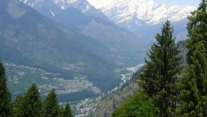
Day 1: Arrival in Manali
- Reach Manali by morning and check-in to a hotel.
- Spend the day exploring Manali and acclimatizing to the altitude.
- Overnight stay in Manali.
-
Day 2: Drive from Manali to Batal
- After breakfast, drive from Manali to Batal (4-5 hours).
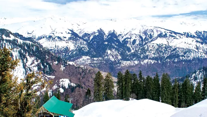
- On the way, you will pass through the Rohtang Pass and the Kunzum Pass.
- Reach Batal and set up camp for the night.
- Overnight stay in tents.
-
Day 3: Trek from Batal to Chandratal
- Start the trek from Batal to Chandratal Lake (6-7 hours).
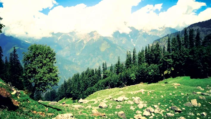
- The trek involves a gradual ascent, passing through scenic meadows and rocky terrain.
- Reach Chandratal Lake and set up camp for the night.
- Spend the evening exploring the area around the lake and enjoying the views.
- Overnight stay in tents.
-
Day 4: Trek from Chandratal to Batal
- After breakfast, start the trek back to Batal (6-7 hours).
- The trek is downhill and offers beautiful views of the surrounding mountains and valleys.
- Reach Batal and set up camp for the night.
- Overnight stay in tents.
-
Day 5: Trek back to Bakarthach
- Drive from Batal to Manali
- After breakfast, drive back to Manali (4-5 hours).
- Reach Manali and check-in to a hotel.
- Spend the rest of the day relaxing and exploring Manali.
- Overnight stay in Manali.
-
Day 6: Departure from Manali
- After breakfast, check out from the hotel and depart from Manali.
ChandraTal Trek Quick Facts
- Location : Himachal Pradesh, India.
- Starting Point : Batal
- End Point: Batal
- Maximum Altitude: 4,300 meters (Chandratal Lake)
- Trek Duration : 3-4 days
- Difficulty Level: Moderate to difficult
- Best Time to Visit : Mid-June to Mid-October
- Permits: A permit is required from the forest department to enter the region.
- Accommodation: Tented accommodation is available during the trek.
- Nearest Town: Manali (approximately 190 kilometers from Batal)
Best Time to visit the ChandraTal Trek
The best time to visit the ChandraTal Trek is during the summer months, from June to September. During this time, the weather is pleasant, and the snow has melted, making the trekking trail accessible. The temperature during the day remains around 15°C to 20°C, and it can get cold during the night, with temperatures dropping to around 5°C to 10°C.
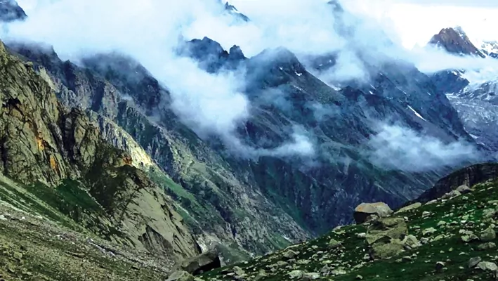
It is important to note that the ChandraTal Trek is located in a remote area of Himachal Pradesh, and the weather can be unpredictable. It is advisable to check the weather forecast and plan your trek accordingly. Also, it is recommended to carry warm clothing and rain gear, as there can be sudden changes in weather conditions.
How To Get There
To get to the ChandraTal Trek, you can follow the below-mentioned routes:
The nearest town to ChandraTal is Manali, which is well connected by road with Delhi, Chandigarh, and other major cities in northern India. From Manali, you can hire a taxi or take a local bus to reach Batal, which is the base camp for the trek. From Batal, the trek to Chandra Tal begins, which is about 14 km.
The nearest railway station to ChandraTal is Joginder Nagar Railway Station, which is about 165 km from ChandraTal. From Joginder Nagar, you can hire a taxi or take a local bus to reach Manali.
The nearest airport to ChandraTal is Bhuntar Airport in Kullu, which is well-connected to Delhi and Chandigarh. From Bhuntar, you can hire a taxi to reach Manali, which is about 50 km from the airport.
Once you reach Manali or Batal, you can hire a local guide or join a trekking group to complete the ChandraTal Trek. It is advisable to plan your travel in advance and make necessary bookings to avoid any last-minute hassles.
Frequently Asked Questions About ChandraTal Trek
What is the difficulty level of the ChandraTal Trek?
The ChandraTal Trek is considered a moderate to difficult trek, with altitudes ranging from 10,000 feet to 14,000 feet. The terrain is rugged and challenging, and the weather conditions can be unpredictable. Therefore, it is advisable to have prior trekking experience and be physically fit to undertake this trek.
What is the best time to do the ChandraTal Trek?
The best time to do the ChandraTal Trek is during the summer months, from June to September, when the snow has melted, and the weather is pleasant. However, it is advisable to check the weather forecast before planning your trek.
What is the duration of the ChandraTal Trek?
The ChandraTal Trek is a five to six-day trek, depending on the route you choose and your trekking speed.
What are the accommodation options during the ChandraTal Trek?
During the trek, you can stay in tents or campsites provided by the trekking company. There are also small guesthouses and homestays in the nearby villages.
Is it necessary to hire a guide for the ChandraTal Trek?
It is advisable to hire a guide for the ChandraTal Trek, especially if you are a first-time trekker or not familiar with the terrain. The guide will ensure your safety and also provide you with information about the local flora and fauna.
What are the essential things to carry for the ChandraTal Trek?
Some of the essential things to carry for the ChandraTal Trek include warm clothing, trekking shoes, rain gear, a first-aid kit, a water bottle, a headlamp, a trekking pole, and sunscreen lotion. It is also advisable to carry some dry fruits and energy bars for instant energy during the trek.
Are there any restrictions on the ChandraTal Trek?
As the ChandraTal Trek is located in a sensitive region, there are certain restrictions on camping and trekking in the area. It is advisable to obtain the necessary permits from the local authorities and follow the rules and regulations.
At a Glance
- 32.4244° N, 77.6492°
- India
-
Himachal Pradesh
- 12,772 ft
- Moderate
- 5-6 hours
- 4 km